The Fish and Scales Topographic Map of South Africa

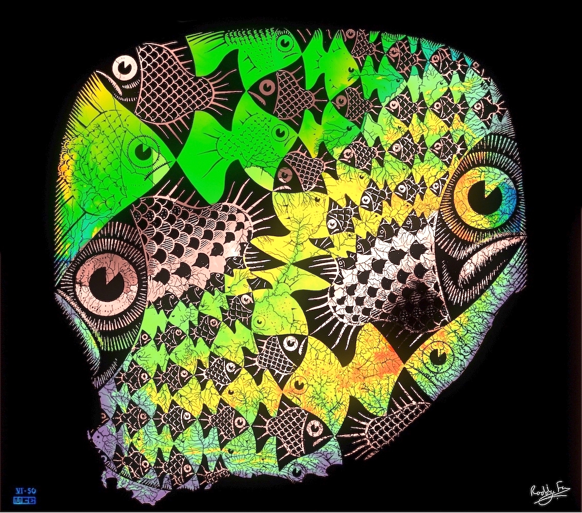
MC Escher produced his famous Fish and Scales print in 1950 – at the same time as The Butterflies. And so, following on from my re-imagination of The Butterflies in yesterday’s post, I’ve used the same method to produce the Fish and Scales Topographic Map of South Africa. You should be able to pick out the country’s coastline easily. The north-eastern edge of Escher’s print follows the curves of the Limpopo River whilst in the north-west it follows the Orange. I’d like to think that he would appreciate the playful colouring!

The Fish and Scales Topographic Map of South Africa
Escher's Fish and Scales
Escher’s Fish and Scales

Leave a Reply

Fill in your details below or click an icon to log in:

WordPress.com Logo

You are commenting using your WordPress.com account. Log Out /  Change )

Facebook photo

You are commenting using your Facebook account. Log Out /  Change )

Connecting to %s

This site uses Akismet to reduce spam. Learn how your comment data is processed.

Create a website or blog at WordPress.com

Up ↑

%d bloggers like this: