Cathedral, Church and Chapel: three pictures of Grahamstown

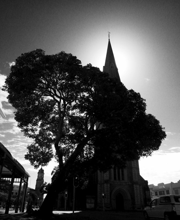
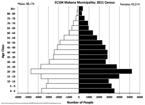
Grahamstown's well-known as 'the city of Saints'. It's a bit of a cliche and so are many of the photos of our city. Picture postcard shots of the imposing cathedral and Victorian shop facades in Church Square spring to mind.  I thought I'd try and get something a little different that gave a bit more... Continue Reading →
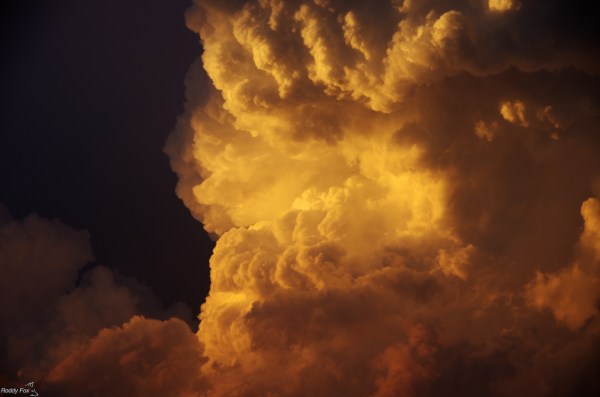
Different Views of Rhodes University

Here are some different views of Rhodes University, Grahamstown. The original pictures were taken using my cheap phone camera and then reworked using WordFoto: Rhodes University and Grahamstown are the keywords.  These will have to change, of course, and I will need to do more pictures if we ever rename the University and city …..  The... Continue Reading →

Echo of the Scream

Edvard Munch's 'The Scream' is one of the world's most easily remembered works of expressionist art. Imagine my surprise to see echoes of the painting in the scum below the bridge in Grahamstown's Botanic Gardens. Echo one: I was on a bridge. Echo two: there was a distorted shape in the watery scum. Echo three:... Continue Reading →

Indian or Asian Population map: Grahamstown 2011

This is the last of the four maps based on data in the 2011 Population Census and it plots the dispersal of Grahamstown's small number of Indians or Asians (total 484). The distribution of Grahamstown's Indian or Asian population shows a wide spread through the former white areas.  Their group area was located two kilometres almost... Continue Reading →

White Population map: Grahamstown 2011

With 5657 people the white population was the third largest group in Grahamstown recorded in the 2011 Population Census.  The map of their distribution shows that the centre of gravity (weighted mean centre) lies approximately one kilometre north west of the Cathedral.  Most of the white population live in the northern suburbs and western side... Continue Reading →

Coloured Population map: Grahamstown 2011

The distribution of the coloured population (total 7615) is the second map in this series showing Grahamstown's racial distributions in 2011.  The main concentration is still immediately to the west of the townships, especially to the northern side of the urban area.  This isn't surprising as the coloured group area was located there: north of... Continue Reading →

Black African Population map: Grahamstown 2011

This is the first of a number of posts mapping racial data and shows Grahamstown's Black African population using information extracted from the 2011 Census. The most detailed geographical statistics from the Population Census consist of information for very small areas (the so called small area layer).  There are over 50,000 small areas in South... Continue Reading →

Midwinter sunset: red sky at night = festinos delight?

I went out to take pictures of the large full moon rising tonight - no success with those - but there was a spectacular sunset to soak up.  Grahamstown seems to specialise in midwinter sunsets but you have to be quick as the play of light alters very rapidly.  These two pictures were taken only... Continue Reading →

Population Census 2011: Makana Municipality’s Age-Sex data

There has been a good deal of public discussion about the recently released 2011 population census and it is now possible to start to see some of the local level information. I downloaded the spreadsheet of age-sex information for all of the country's municipalities from the website of Statistics South Africa.  Then it was a... Continue Reading →

Stormy Sunset over Grahamstown

This last two weeks have been extremely wet in Grahamstown which has led to the main road from Port Elizabeth collapsing completely.  There are some great pictures here in Grocott's Mail. On Thursday, after 10 days of rain, we got a day of warmth and sunshine which led to the most spectacular and menacing storm... Continue Reading →

Create a website or blog at WordPress.com

Up ↑