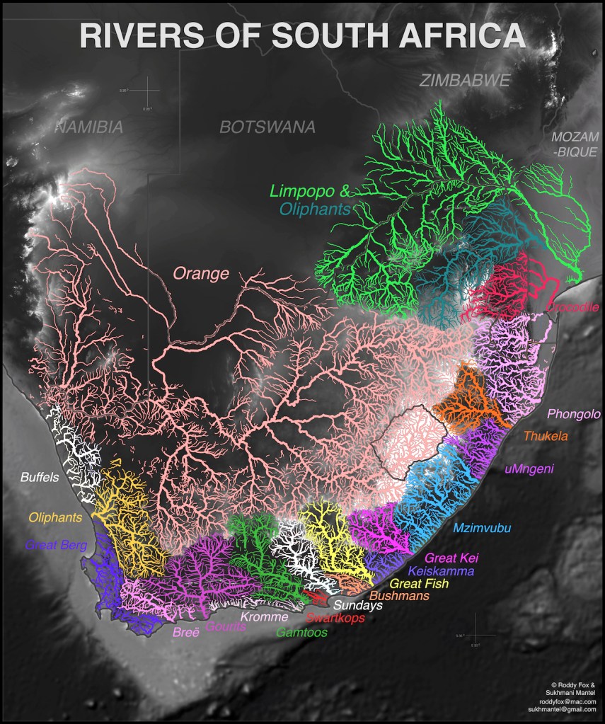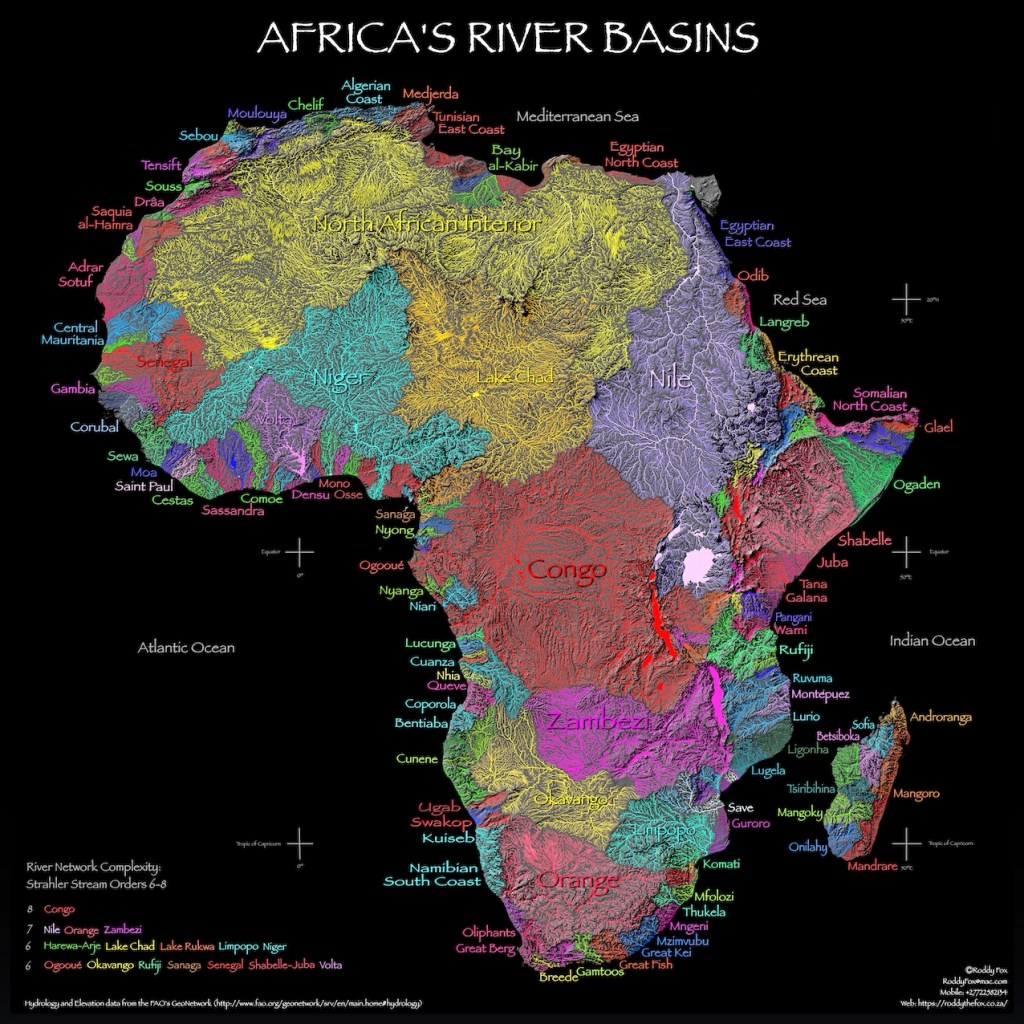
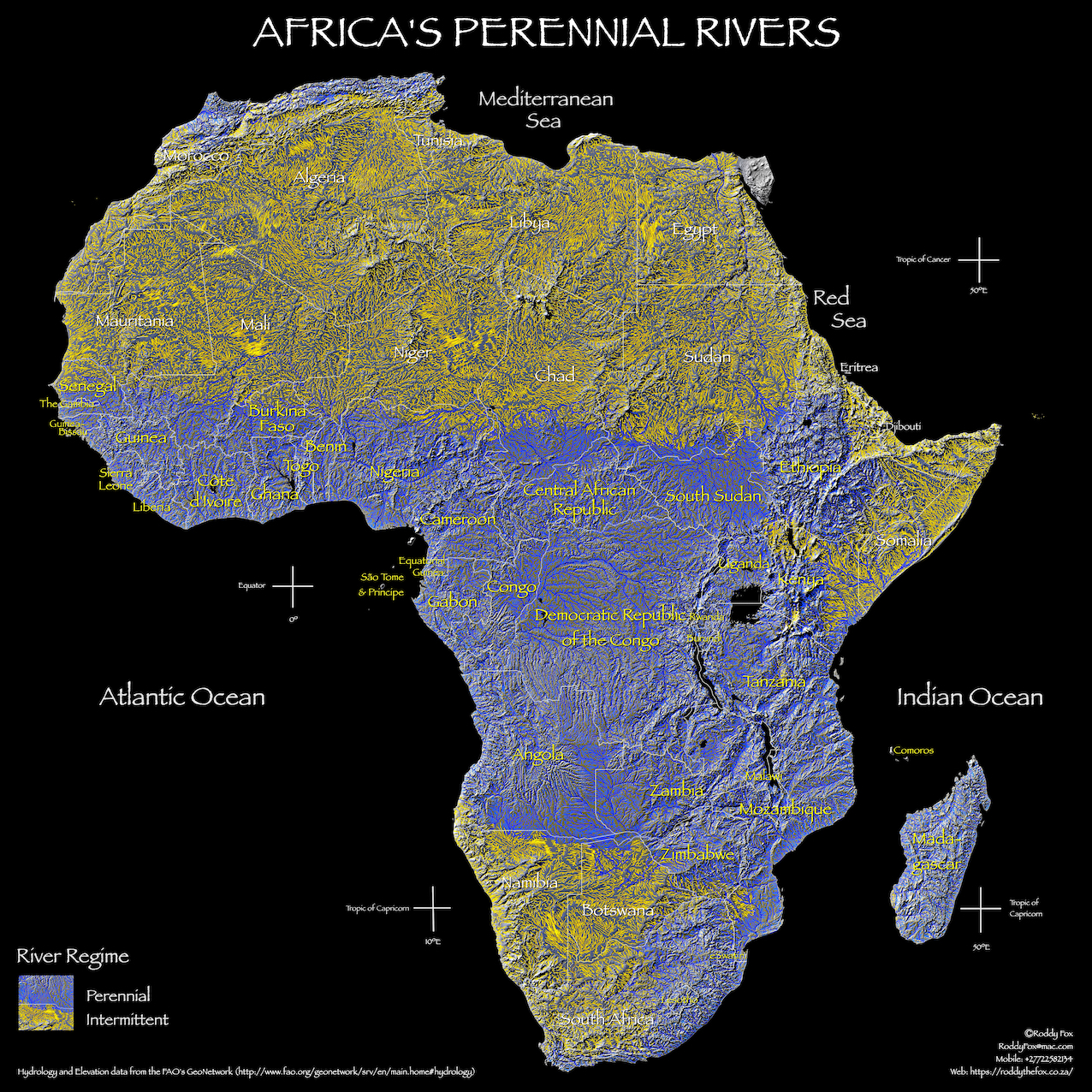
Every once in a while I’ll return to one of my lifetime’s passions – making maps. This post is about one of the biggest mapping problems. If you look either at the header to this post or some of the beautiful maps of South Africa’s river networks they give the impression that the region is full of rivers and streams. But there are rivers and streams marked on this kind of map that are only very occasionally there: they might only flow once or twice in ten years. In fact that’s what’s happened this past two years in Namibia. I can show you this with these two maps: one that colour codes all of the rivers and basins in Africa and the other that shows which are permanent (blue) and which are only intermittent (yellow). The map scales are slightly different but I’m sure that if you drag the slider across you can see the point that I am making.

I’ve produced a number of full size wall maps of Africa’s river basins and one shows the permanent and intermittent rivers. Wherever possible I’ve overlaid the rivers and river basins on top of relief shading and inserted country and major river labels because I think that further helps you understand the geography of the continent. They were produced using Cartographica and PhotoScapeX. There’s a slideshow preview below: and if you are interested there are full sized images available in my Maps and Wall Art Gallery.